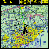
Global Positioning System (GPS)
PathAway navigation system uses satellite signals to determine
your exact location, speed and direction of travel. PathAway
will work with most handheld GPS units, Palm Add-on GPS devices,
Compact Flash GPS, and Bluetooth GPS.
Supports any NMEA0183 v2.0 or higher compatible GPS device
(this encompases the majority of GPS devices on the market).
Delorme Earthmate™, and Tripmate™ proprietary protocols are
also supported.
GPS is not required to use the software. Pathaway's powerful
hi-res mapping engine allows you to capture and view all your
maps.
Navigation
- GPS support for most devices.
- Display current location, elevation, speed, and direction.
- Moving map centers on your current location.
- Record your track for later back-tracking, or reviewing
the journey.
- Proximity notification displays points you are approaching,
their distance away, and position relative to your direction
of travel.
Maps
 -
Prepare your own maps for use in PathAway, using the free
Map Manager application. Scan your paper maps or get digital
maps from CD ROM software, or web sites. -
Prepare your own maps for use in PathAway, using the free
Map Manager application. Scan your paper maps or get digital
maps from CD ROM software, or web sites.
- Multi-resolution color support. (Grayscale, 256 color, and
new high definition color).
- Zoom in-out between maps of different resolution.
- Scroll by dragging map with the stylus.
- Map calibration. Once maps have been transferred to the
device, you can fine-tune the map coordinates by matching
the positions of known points on the maps, with the actual
position displayed by the map.
Points
- Capture and mark unlimited number of points and locations.
- Use long names and descriptions for easy recognition.
- Apply an icon to each point. Even create your own icons
using PathAway Tools for Windows.
- Goto points on the map, or points along a track.
Routes
- Create routes by simply clicking points on a map, or by
adding points from your Points database.
- Choose a recorded track to follow.
- Follow routes either forward or reverse (back-track). Great
for finding your way home.
- Simulate (play) your route travel before you go.
- Determine your total distance and estimated travel time
to destination. Time can be estimated by current speed, average
speed, or a custom speed setting.
Tracks
- PathAway can record your location at regular intervals
as you travel with a GPS.
- The track line is displayed on the map as you travel.
- You can then reuse the track to follow at a later time.
- Time and distance are recorded in the track log, useful
for accurate travel planning.
- All track points can be added to your points database.
Screen Views
- Full Screen Map View
- Route View
- Tracking View
- Proximity View
- Points View
User Interface
- Preferences for distance and elevation units, course display,
time estimation, proximity notification, map display detail,
and track recording precision.
- Use of Palm "hard" keys for easily adding points,
scrolling maps, changing views, connecting/disconnecting to
GPS.
Data Management (on Palm OS)
- Edit point, route, and track databases including: changing
order, renaming, joining, duplicating, and copying records
between databases.
- Beam databases to others.
Windows PC-based Management
PathAway Tools - Map Manager
- For preparing maps to use on the device. You just need
to specify the longitude and latitude coordinates of each
map.
PathAway Tools - Icon Manager
- For adding icons for points and vehicles to be used
on the device. Create your own using a bitmap editor, and
add them to your icons database.
PathAway Tools - Database Import/Export
- Import/export Points, routes, and track databases. transfer
between standard comma-delimited files. (currently available
in command prompt and Windows DLL only)
|
