Versatile
One App, many uses!! PathAway is suitable for any outdoor activity or task where location is important.
Proven
Since 1999, PathAway has worked closely with its users to evolve the products into easy to use, feature rich applications.
Possibilities
If you get out and go places, PathAway is the App to get you there and bring you back safely.
PathAway for me is still the best program.
by Walter, Germany
PathAway has to be the best moving map app I've used.
by Richard, Australia
Many thanks by the way for your great piece of software.
by Thomas, Germany
Other Platforms: Windows Mobile, Symbian, PalmOS.
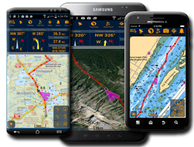
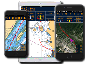
GPS Navigation, Route Planning, Tracking, and Mapping App
PathAway is the ultimate App for outdoor navigation, tracking, route planning, and mapping activities such as boating, hiking, flying, cycling, running, offroad, touring, geocaching, racing, athletic training, ballooning, fishing, hunting, paragliding, mountain climbing, canoeing, snowmobiling, scuba diving. Businesses use PathAway for mapping/GIS, mining, military training, surveying, site inspection, field data collection, search and rescue, or any activity where location is important.
There are No Limits.
The great outdoors have no limits, so why should your App? PathAway PRO has everything from recording an unlimited number of tracks, create and import unlimited number of routes to navigate, track an unlimited number of friends, assets, or pets, create or import an unlimited number of your own maps, or use the automatically downloaded maps, capture an unlimited number of location points and annotate them with pictures and descriptions. You can even modify the screens and map overlays to suit your specific purpose. Even if you go beyond the limits of cell towers, PathAway will still retain your maps and data.
Designed for Robust Use.
We’ve been developing GPS Apps for mobile devices for over 15 years, largely based on user feedback and recommendations. The creative design of PathAway PRO has grown to be the companion you can trust to get you out there, and to bring you back safely. Its time proven core engine manages all the monitoring and recording data efficiently and robustly. You can count on PathAway PRO to handle the most challenging tasks in the Outdoors.
Unparalleled Versatility.
PathAway’s features have been carefully designed to embrace the widest range of activities in the field. PathAway Pro is designed to handle activities from navigating a tight waterway, to traversing a mountain trail, to mapping property boundaries, to collecting wildlife data.
Users have their Say.
"Perfect for Off Road Navigation!”, “Best GPS App yet!I”, "All other programs have fallen behind now! So just super. Now, the dream tool is here!!", " The cool thing is that you can layer maps and switch between them. I have used this for flight, boating and hiking."
It’s An Evolution.
PathAway's feature-set has been built on our success and experience over the years. Of significance, PathAway PRO enables users to send their location to others, and to monitor where others are, right on their handheld unit. Locations can be sent and received directly to other iOS or Android devices, or sent to a central tracking service. This makes PathAway ideal for activities such as group travel, search and rescue operations, competitive sports, or people and asset tracking.
Basic to Advanced versions available
- LE Edition: Designed to get you started with free downloadable maps.
- Express Edition: More powerful features including the ability to create or import your own custom maps and charts.
- PRO Edition: Completely customizable with great features for the most demanding outdoor adventurers and professionals. Includes incredible features such as location sharing, area and distance measuring tools, Elevation and Speed Profile Views, multi track/route display, data folder management and more. The PRO Edition represents the culmination of our experience building world-class software trusted by the most demanding users.
All products include English, French, German, Italian, Spanish, Czech, Swedish, Portuguese languages.
 Where your Adventure Begins
Video showing PathAway Benefits and Features
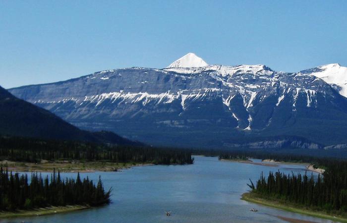
Outdoor Adventure
Take PathAway with you for any of your outdoor adventures. Off-road driving, backpacking/hiking, road cycling, mountain biking, trail and road running, mountain climbing, cross-country skiing, downhill skiing, snowboarding, general touring and travel are all enhanced with this navigation app.
Download or create epic routes to follow. Track your progress, share with friends. Mark favorite spots with text, pictures, and video. Track-back to find your way home. Measure time and distance, monitor speed to determine estimated arrival time. Watch the animated weather forecast overlays along your route to avoid inclement weather.

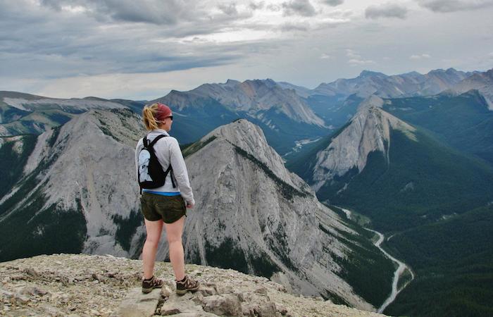
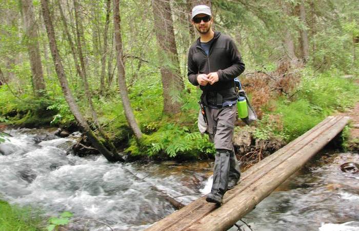
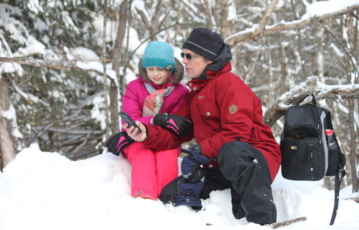
Hiking/Backpacking/Trekking
Use PathAway as your guide for your hiking, backpacking, mountain climbing or trekking adventure. Plan your trip and then follow your routes back to avoid getting lost. Be secure in the wilderness with alerts if you stray off-track. Enjoy the natural beauty of the outdoors with this mobile mapping app that you can determine location and details of weather with the new weather subscriptions. Calculate distances and determine best plans for each days adventure.
Subscribe to the weather overlays for real time forecasting synced directly over maps to assist in planning the safest routes.
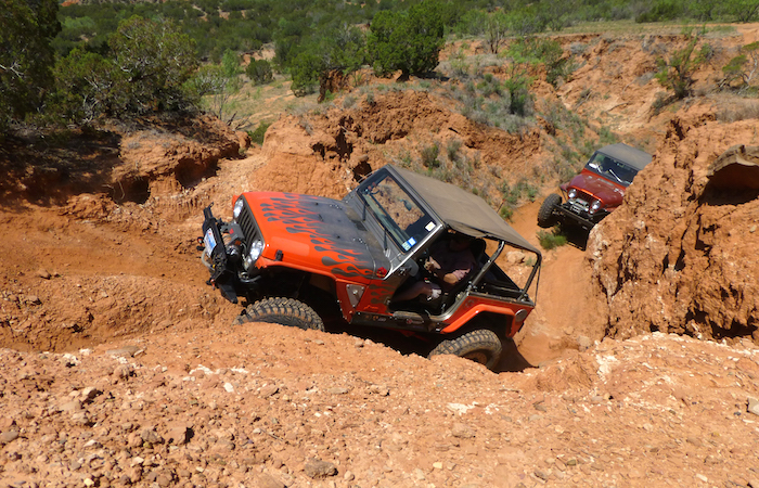
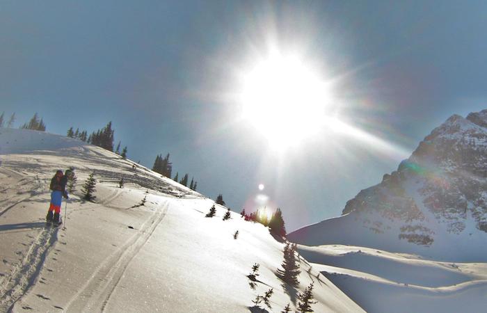
Offroad Navigation
PathAway is made for navigating custom created navigation routes, perfect for offroad adventure and racing. Download maps for offline use so the response is there when're out on the remote track. Get detailed navigation heading compass, speed, average speed, distance and estimated time to next point or destination.
With PRO, upload your location for others to monitor, or view other's locations on the map. Utilize Elevation Profile for enhanced visualization.
Watch the animated weather forecast overlays to prepare for upcoming inclement weather.
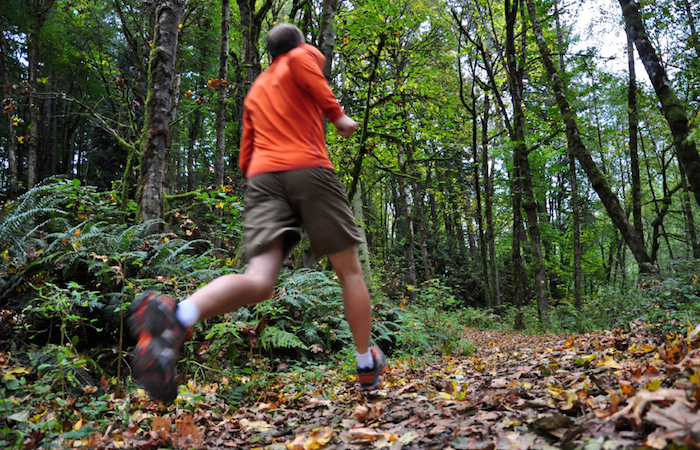
Running
PathAway has many features suitable for trail running or road running. Track your runs with detail such as pace, elevation, average/max/min pace. Create or import trail routes. If running in a group, then use Location Sharing to monitor positions of each other runner. Use BackTrack to find your way back if you get lost on a trail, or to compare your pace with the outbound run. Replay and analyze your run later. Share your routes with friends.
Subscribe to the weather overlays for real time forecasting to determine if you’ll get that run in before inclement weather arrives.
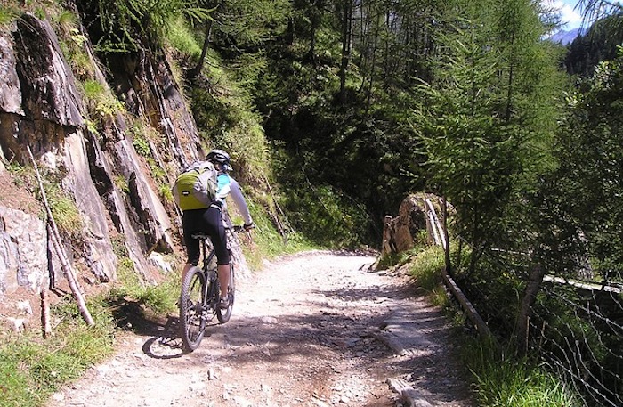
Cycling/Mountain Biking/Cycle Touring
PathAway is great for mountain biking on trails, or road bike touring or training. Track your rides with detail such as speed, elevation, average/max/min speed. Create or import trail routes and follow the routes by mounting your device on your handlebars. For touring, mark your favourite points, with text, pictures and video. If cycling in a group, then use Location Sharing to monitor positions of each other cyclist. Use BackTrack to find your way back if you get lost on a trail, or to compare your pace with the outbound ride. Replay and analyze your ride later. Share your routes with friends.
Subscribe to the weather overlays for real time forecasting to avoid inclement weather along the way, or to determine whether to bring rain gear along.
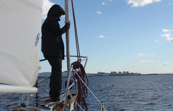
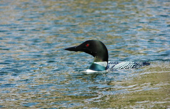
Marine
Whatever your activity on the water, be it Sailing, Powerboating, Paddling, Scuba Diving, PathAway has great features to assist in navigating the waters, and providing the security you need to be find your way home safely.
Download waypoint markers to warn you of hazards along your route. Plan your complete route and follow the course. PathAway will alert you if you stray off-course. Or just record your travels and then use BackTrack to find your way back home. View online maps, or download them beforehand for use where no internet connection is available. With Express or PRO Edition, convert and install your own charts for use in navigation.
Subscribe to the weather overlays for real time forecasting synced directly onto charts to ensure you’re aware of inclement weather or the effects of the wind and waves, and adjust your route accordingly.
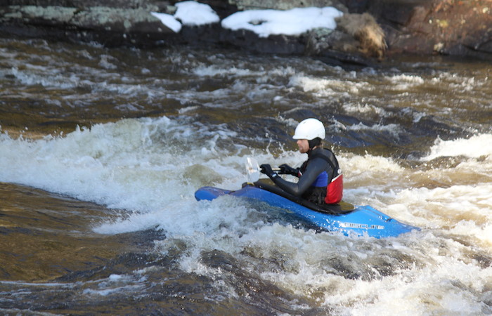
Paddling
PathAway is an ideal trip navigator for your backcountry canoe/kayak adventures.
Use PathAway for trip planning by importing existing routes, or creating your own from the available free maps. Download the maps to your device beforehand so they're avaialble when you travel out of internet range. Even create your own maps of your favourite area by scanning or acquiring then converting to PathAway format.
Import data points such as available campsites, portages, and outdoor supplies.
Once on the water, track your route for later review and sharing, mark geotagged points with descriptions, photos, and video. Track your progress with estimated time of arrival along a route to ensure you get to your destination before dark.
Subscribe to the weather overlays for real time forecasting to ensure you're aware of inclement weather or the effects of the wind, and adjust your route accordingly.
Tracking and Location Sharing
PathAway has numerous tracking abilities, both offline or Online Location Sharing.
Record your track off-line for later viewing, sharing, or re-using as a navigation route. Recorded tracks can be used to "BackTrack" to find your way home
You can have friends and family track you as you explore the great outdoors! Or you can track friends as you travel. Great for group travelling or events where you want to know where others are in relation to you.
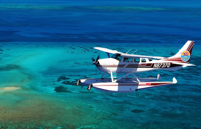
Aviation
Use PathAway for Small Plane aviation, ultralight flying, ballooning, or paragliding. A great backup for in-cockpit electronics. View and follow Aviation charts. Download and monitor waypoints and markers. Additional special features specifically for flight include altitude, vertical speed, and alarms for high/low elevation, off track warning, and point proximity warnings.
Plan and follow routes. Create waypoints to describe destination airports or import Airport information.
Subscribe to the weather overlays for real time forecasting synced directly onto maps allowing for planning of daily management.
Geocaching
Geocache with PathAway to get you to the cache, mark it, and find your way back.
PathAway can import Geocaching Data files so you can view the Geocache details and follow the GPS to the location.
Create new Geocaches by marking the location, and export the file for upload for sharing on Geocaching Websites
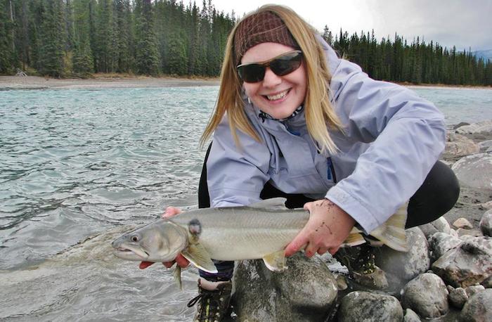
Fishing
For the fishing enthusiast, PathAway is a great companion. Create logs and details directly on the map showing location details, fish caught, tackle used, and fishing technique. Know where and when the fish will be biting for next time. Use free maps, or Scan, purchase and download your own fishing maps and convert them for use on your device. Track your way to find your way back.
Subscribe to the weather overlays for real time forecasting synced directly onto maps to ensure you'll be safe out there, as well as to know the best conditions when the fish are feeding.
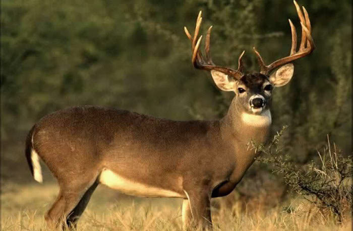
Hunting
PathAway provides a critical tool for skillful tracking and planning trips for hunting. Having ongoing support of a location based navigation assistant will make acquisition of an elusive target, easier. Mark locations of game sightings, or locations of blinds with text and photos. Track-back to find your way out of the forest.
Attach Trackers to your dogs, and use PathAway to monitor their location.
View different map layouts. Download and cache online maps for offline use on the device when you're out of cell tower range. Or scan/download a map for your area, and convert it for use in PathAway.
Subscribe to the weather overlays for real time forecasting synced directly onto maps allowing for planning and early warning of inclement weather.
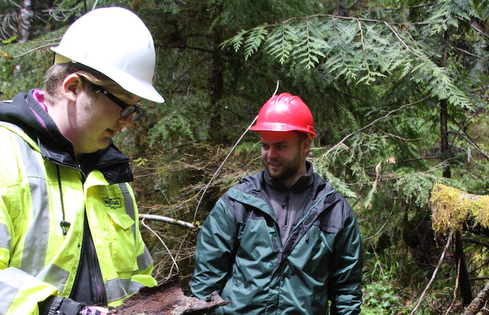
For Professional Use
PathAway is designed to make location and travel related businesses more efficient. Easy to use and accurate ability to record track logs, track other employees or assets, create point-to-point routes to develop optimal travel time, add location point details such as text, photos and videos. All routes, points, and track logs can be saved and exported for external use. Specific packages are available and PathAway can be customized.
PathAway Pro is completely customizable, and can be configured to suite the exact purposes. Convert and Import any map or use the free available maps. Import points, routes, and track logs. Change the User Interface details, and trip statistics.
Subscribe to the weather overlays for real time forecasting synced directly onto maps for optimizing time-sensitive routes.
On Device Tracking
Record your track off-line for later viewing, sharing, or re-using as a navigation route. Recorded tracks can be used to "BackTrack" to find your way home
Record property boundary perimeters, calculate area, and lot dimensions. Export the the track logs for analysis.
Forestry and Agriculture
PathAway offers support for efficient tracking, planning and productivity in crop and forest management. Using PathAway, add details, photos and videos that will offer valuable information for future analysis for years to come. Track field turn over, drought and flooding areas creating plans for field enhancement needed before the next season. In relation to forestry, track all details in managing, using, conserving, and repairing forests.
Subscribe to the weather overlays for real time forecasting synced directly onto maps for planning of daily activities.
Military
Whether training or on missions, PathAway is an App that can increase the efficiency of all personnel on any assignment or operation. Useful for conducting daily domestic and continental operations and in any situation where forces are deployed to a crises or natural disaster. Easy to use for tracking locations, keeping routes, and adding details. Mark important points and attach text, photo, or video. Ability to be tracked or track others via location sharing. Supports MGRS coordinate system.
PRO Edition recommended. Specific packages are obtainable and can be customized.
Subscribe to the weather overlays for real time forecasting synced directly onto maps for planning time-sensitive maneuvers.

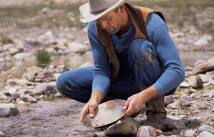
Mining
Travel, locate and track all details of Mining projects. Capture details and photos or videos at specific locations while prospecting. Efficiently manage complex details of extraction sites. Easy to use for tracking locations, keeping routes, and adding details. Mark important details directly on maps with text, photos, or video.
PRO Edition recommended. Specific packages are obtainable and can be customized.
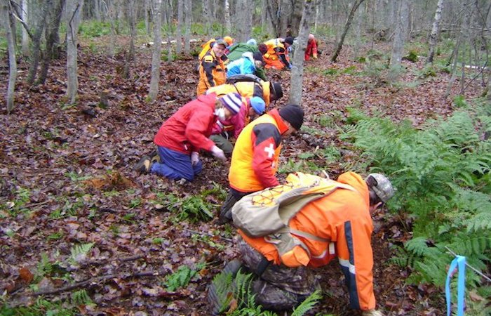
Search and Rescue
Use PathAway for search and rescue efforts. Track the route of each search personnel in real-time with location tracking, or on-device for later analysis. Create map routes for the most efficient coverage of search area. Add text details, pictures and video of any possible evidence found along the way.
PRO Edition recommended. Specific packages are obtainable and can be customized.
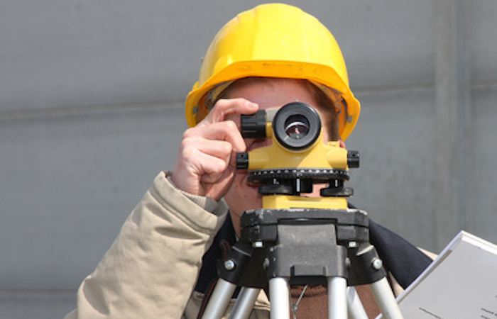
Mapping
PathAway includes numerous features for doing surveying, site inspection, field data collection, and property mapping.
For mapping, simply turn on the breadcrumb track logging, then travel the boundary of the area. PathAway will record the route. Calculate distance measurement and area. Download tracks to your desktop for analysis. Also upload routes for future reference. Mark locations, add text, descriptions, photos and video. Download all points for analysis.
FindMe Location Tracking Service
More then just a feature... An incredible tool to share your location with others via web page or right on your device. If you get separated, easily see where they are!! Keep track of a single person or an entire group while you travel. No special GPS tracking device required. Your smartphone is your tracking device.
FindMe is a simple service for sending your location to other devices or to the internet. PathAway Pro offers this incredible feature to easily get you started sharing locations with others.
There are numerous other tracking abilities, including configuration options to setup PathAway to receive locations from your GPS Tracking device or to send/retrieve locations to your preferred tracking service. This gives you the ability to track your dog, an Alzheimers patient, your car/truck/fleet, boat, or any asset.
- GPS Navigation with most GPS Devices (including Bluetooth)
- Wirelessly download maps from the web on-the-fly (WebMaps). No need to calibrate and install maps beforehand. Includes support for Google™ maps, Terraserver, OpenStreetMap.com, OpenCycleMap.com
- Intelligent Moving Map Display
- Add Personal Points of Interest/Waypoints with icon, photo, and notes
- Capture Photo Points from internal camera.
- Multiple Point Databases
- Record and Follow your Tracks
- Instant BackTrack to follow the track you recorded home
- Point to Point Routing
- Proximity and off-track Alarms
- Onscreen Trip Statistics on a Customizable Dashboard
- Multiple coordinate grid display including lat/long, UTM, OSGB, MGRS, MGA and many more.
- Map View, Compass View
- Map Projections, UTM, OSGB, and Datum support
- Support for Google Earth KML/KMZ, GPX, LOC, or text delimited data
- Precision Animated Weather Forecast Overlays. (Android only)
- Create and Import your own Maps using PathAway Map Manager. Import Worldfile, JPR, GeoTiff, or any bitmap image
- Many Map Projections support.
- Display BSB/KAP maps without conversion.
- Automatic map rotation while navigating.
- All of the features of Express and Standard Editions plus new features targeted towards power users and professionals
- Send your Location to other PathAway users or to a central tracking service. Http and SMS support.
- Monitor shared locations on your handheld.
- Left/right, high/low directional alarms;
- Area Calculation and Distance Measurement.
- Additional Customizable Map View screens
- Map Calibrate and adjustments on the device.
- Show all or multiple recorded tracks and routes on the map.
- Advanced Track and Route Editting features such as Split, Join, Duplicate
- Backup and Restore Data. Backup to PathAway Cloud using your PathAway Account.
- Calculate new Location from relative distance and direction (great for Geocaching);
- Pace-keeping features for racing, training, or arrival-time scheduling