|
The following is a sampling of some of the screens found
in PathAway
PathAway Standard and Professional Edition Screenshots:
PathAway Professional Edition Screenshots:
|
|
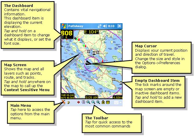
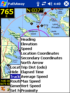
PathAway Main Screen Components
|
Screen Views
|
Full Screen Map View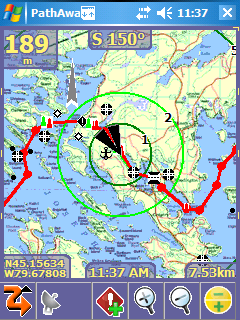
Utilizes full screen to give the largest map viewing area. |
Customizable Compass View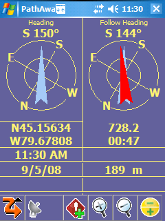
Show important information in large text with Compass-Like displays. |
|
|
Tracking View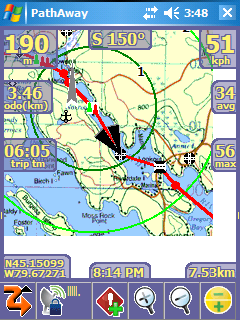
Shows Time, Speed, Distance, information. Blue line on map
indicates recorded track.
|
Route View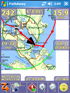
Shows route progress. How close to your route track. Time, distance
and course to next point and destination. Red line indicates
current route. |
|
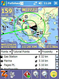
Proximity View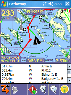
Tells you where Points are from you. Point Icons are shown on
the maps. |
Point View
Shows items from the points, tracks and route databases. Allows
displaying them on the map or placing them into a route. |
|
GPS Sky View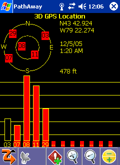
Graphical view of location, fix type, and signal strength of
each satellite. |
GPS Data View
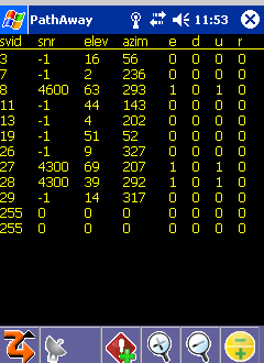
Shows individual satelite signal information |
|
Optional Finger Touch Menu System
Use standard cascading menus, or the new Easy finger touch user
interface for menu selection. the new Finger Touch menus are
displayed similarly to the dashboard with transparent Iconic
command options. This allows you to keep navigating while selecting
an option. Great if you're travelling and only have a few seconds
at a time to choose menu commands. |
Main Menu
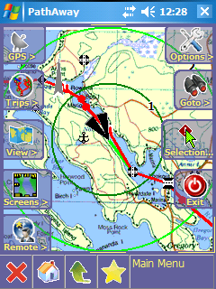
"Finger Touch" main menu. Includes a "Favorites
Menu". Add your favourite commands for easy access. |
Screens Menu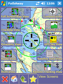
Finger Touch menu for selecting PathAway's Customizable Screens.
|
|
Customizable Dashboard
|
Customize Dashboard
Customizable Dash Options allow you to see the information you
want. |
Customize Dashboard
Routing, Tracking, or General information can be chosen to be
placed on the dashboard. |
|
GPS Configuration
|
GPS Configuration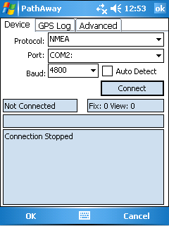
Setup for GPS device. Watch GPS input stream to ensure communication
is working properly. |
GPS Configuration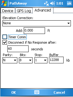
Setup for GPS device. Advanced GPS options to ensure your device
works as you want. |
|
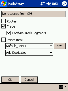
Start New Trip Dialog
|
Start New Trip Dialog
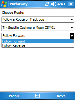 Options for choosing a route, track or point to navigate with,
transportation mode, and track logging options.
Options for choosing a route, track or point to navigate with,
transportation mode, and track logging options. |
Start New Trip Dialog
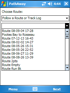
Easy selecting of route or track log to navigate with.
|
|
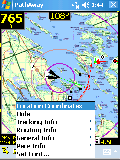
Tap Screen Context Menu
|
Tap Screen Context Menus
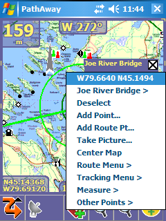 Tap
on the screen to get quick access to availables options, as
well as perform common commands. Tap
on the screen to get quick access to availables options, as
well as perform common commands. |
Tap Screen Context Menus
Tap on a point to get details, or to edit it.
|
|
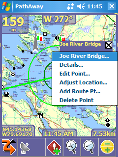
Tap Screen Context Menus
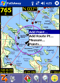 Point Menu allows you to add a new point, add a point to a route,
or measure distance between two points.
Point Menu allows you to add a new point, add a point to a route,
or measure distance between two points. |
Tap Screen Context Menus
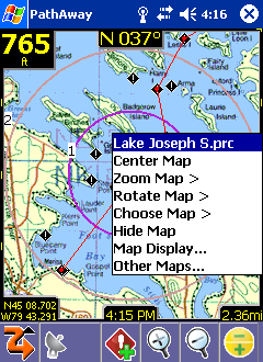
select the Map menu for repositioning the map, zooming in
or out, manually rotate map, or find other maps within the
same boundary, or set map display options.
|
|
Map, Track, Route, Point Database Dialogs
|
Route Databases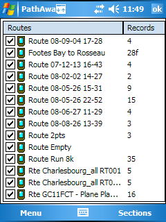
Lists all of your routes. You can create new routes, edit a
route, or choose an existing route to follow forward or reverse. |
Route Details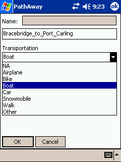
Edit route information such as name, and mode of transportation.
|
|
Recorded Tracks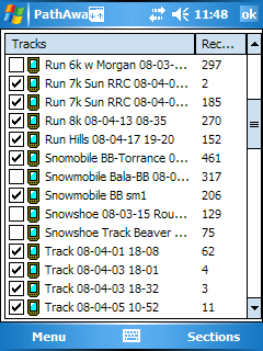
Lists of your recorded tracks. Choose a track to follow for
pin-point accurate routing. |
Download from GPS Device
Manage your tracks by duplicating or joining tracks, and transfer
between Garmin GPS devices. Upload/download tracks, routes,
or points. |
|
Maps 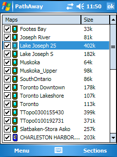
Lists all loaded maps. Choose display to show the map on-screen.
Transfer maps between memory expansion cards. |
Map Details
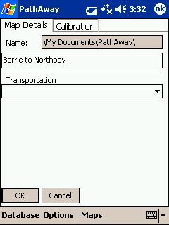
Edit map information such as name, and geographical coordinates. |
|
Map Details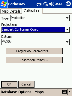
Use Projected maps for precision plotting on wide scale maps |
Map Details
Supports most common map datums. |
|
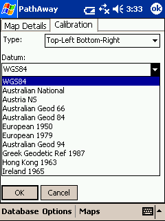
Map Calibrate Options
|
Map Calibrate Options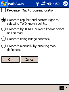
Adjust your map geographical boundaries for pin-point accuracy,
in a number of ways. |
Map Calibrate Options
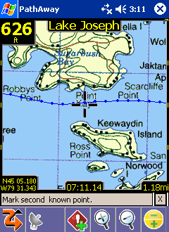
Simple and fast Calibration by selecting two known points
on the map. PathAway does the rest.
|
|
Nudge Map
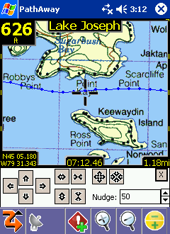
Fine tune your map by nudging it's coordinates in incremental
values. |
Map Calibrate Options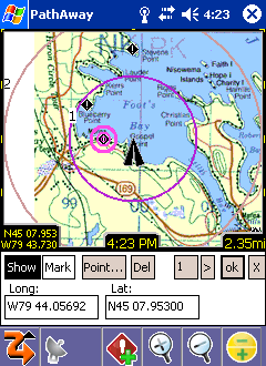
Calibrate by 3 or more known points to get highest map accuracy.
|
|
Edit Point Details
|
Edit Point Details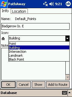
Apply your own custom made icons to your points. |
Edit Point Details
Add a custom alarm sound to associate with a given point. |
|
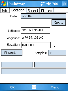
Point Details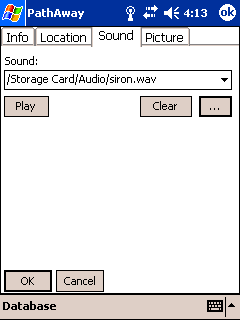
Add a custom alarm sound to associate with a given point. |
Point Details
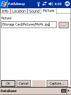
Add a custom picture to associate with a given point. |
|
Preferences Dialogs
|
Preferences
Tracking
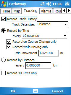
Set track recording preferences. Control how large the track
file can get, and how often data is logged. |
Preferences
Time Estimation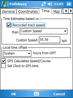
Control how time-based estimates are calculated. Time estimates
can be set to the exact time it took on a followed track. |
|
Preferences
General
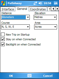
General settings for units of measure. Override handheld's auto
shutoff feature. |
Preferences
Coordinates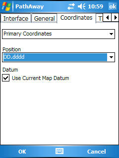
Select primary and secondary display coordinates, in desired
grid, and datum. |
|
Preferences
Map Display
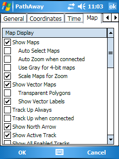
Control how and what information is displayed on the map view
screens. |
Preferences
Map Display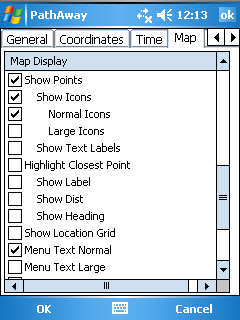
Control how and what information is displayed on the map view
screens. |
|
|
Preferences
Points Options
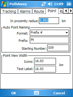
Select proximity alarm radius threshold, point naming options
and icon and label view thresholds.
|
Preferences
Alarms
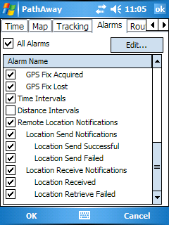
Have audible alarms sound when you reach points of interest,
or get off your route track. |
|
Preferences
Line Style
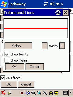
Change the width and color of Route and Track lines for easier
viewing. |
Preferences
Position Marker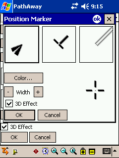
Adjust the size, style, and color of the location postion marker. |
|
PathAway Professional Edition Screenshots
|
Remote Location Tracking
|
Remote Locations shown on Full Screen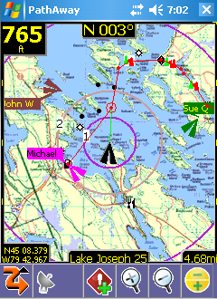
Each Remote location can have it's own colored label. |
Calculate Location 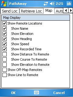
Choose the format of the remote labels. |
|
Remotes View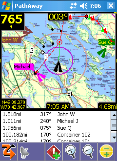
View List of all Remotes and their relative location to your
current location |
Send My Location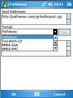
Support major proprietary and microtracker formats. Send via
Http or direct to other users via SMS
|
|
Calculate Location
|
Edit Point - Location
Calculate a new position relative to the current position by
tapping the "Calc..." button |
Calculate Location 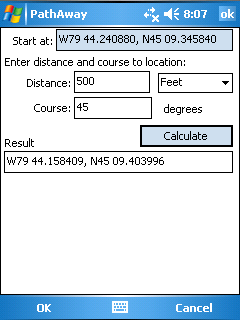
Enter a new distance and course from the start location to calculate
the new location. |
|
WebMaps
|
|
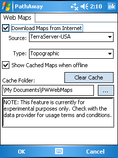
WebMaps feature enables you to download maps from supported
Map Servers on the fly while you travel. In the WebMaps dialog,
you select the Web Server and type of map. You can choose
to store a cache of downloaded maps on your SD Card by changing
the Cache folder.
|
|
|
| |
|
|
| |
|
|
| |
|
|
| |
|
|
| |
|
|
| |
|
|
| |
|
|
| |
|
|
